Sardinia aerial photos: see our fantastic land from above!
Do you want to see our island from the sky? Surely you thought about using the Google Earth spectacular 3D shots to be able to see the areas’ change over the years. You may also have used wikimapia if you are curious to know particular environments.
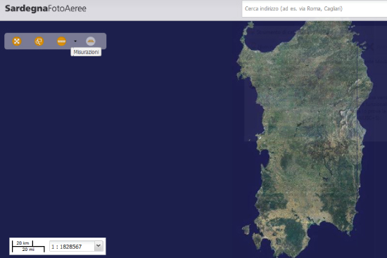
Anyway, today we want to talk about Sardinia Aerial Photos, a browser you can use accessing the site www.sardegnageoportale.it.
Made available by the Region Sardinia SITR Service (Region Territorial Informative System), Sardegna Foto Aeree is a browser for online finding and seeing aerial or satellite Region photographs from 1943 onwards.
The images you find here can be seen in dual map mode, for intertemporal comparisons, and in oblique photo mode, for searching built-up areas.
In the “Images” drop-down menu, you can select the flight plans of the aerial photos and satellite images, containing the information relating to the frame.
You can find the metadata of the orthophotos and satellite images of Sardinia by clicking at the bottom right in the browser.
Cover photo by Ensamar.it


